Real Estate
US States Population MAP
Visualize US population distribution and year-over-year change across all 50 states.
This interactive map lets you zoom, pan, and define custom regions on the fly. Use this Astrato Data App to store new region groupings, explore population estimates by state, and surface demographic patterns at a national scale.

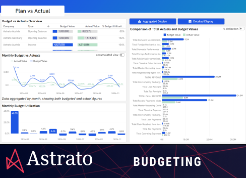
This dashboard is interactive
Change the org, date range or click any chart — data updates on the fly.
Live demo
no login required
More demo apps

Ready to experience next-gen analytics?
See how Astrato runs natively in your warehouse.
SOC 2 Certified
GDPR Compliant
Predictable costs
